
BLOG
A Letter from our drone pilot
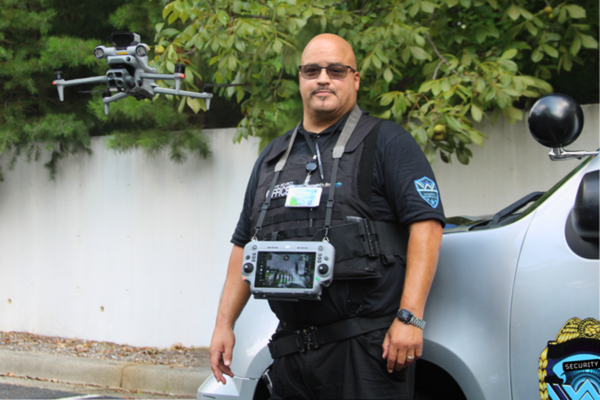
Originally written by Sam Carr, our Commercial Drone Pilot at Weatherspoon Security.
Seeing What Others Can’t: How Thermal Drones Are Changing Inspections and Security
Most people think of drones as a way to get a great aerial photo. That’s still part of the job, but thermal-equipped drones have become practical tools for construction, infrastructure inspection, security, and emergency response. They collect information that would otherwise be hard, risky, or expensive to get from the ground.
As a remote pilot, I help clients see their properties and operations from a different angle, and thermal imaging is one of the most useful capabilities I bring to that work.
Seeing Heat, Not Just Images
A thermal camera picks up temperature differences the naked eye can’t see. That can reveal abnormal heat signatures, electrical problems, failing equipment, water intrusion, insulation gaps, and other spots worth a closer look.
For construction companies and property managers, this means a drone can cover a large area quickly and capture both visual and thermal data. No one has to climb a structure, squeeze into a hard-to-reach space, or stop work for an inspection. It’s safer for crews, and it saves time.
A New Perspective on Security
Thermal imaging also opens up real possibilities in security.
When visibility is poor, such as at night or in conditions where standard cameras struggle, a thermal drone can still show what’s happening on the ground. For authorized security operations, that makes it easier to keep watch over large properties, construction sites, equipment yards, and other areas that are hard to cover on foot.
The goal isn’t to replace security officers. It’s to give them a view from above so they can assess a situation faster and respond with better information.
Construction Site Intelligence
On construction sites, regular flights can document progress, check areas that are difficult to reach, and give everyone a current picture of the site. Thermal imaging adds another layer by flagging temperature anomalies that may need a closer look.
Over the course of a project, that documentation also builds a visual record that project managers, contractors, and other stakeholders can refer back to.
Meet the Pilot: Samuel Carr
Samuel Carr is a commercial drone pilot based in the Charlotte area. Originally from Buffalo, New York, he has called Charlotte home since 2001.
Samuel began flying commercially in 2022 and has since built experience in aerial imaging, inspections, security support, and mission-based operations. He flies platforms equipped with high-resolution cameras, zoom, and thermal sensors, with a particular focus on security, construction, inspection, and infrastructure work. His priority is giving clients information they can act on while keeping people safer and operations running efficiently.
Technology That Works for the Client
Getting a drone in the air is the easy part. The value of a professional operation is in collecting the right information and delivering it in a form that helps the client make decisions.
Whether the need is construction documentation, a thermal inspection, security support, or a general aerial assessment, a well-equipped drone can gather detailed data quickly while keeping personnel out of harm’s way. For many properties, the most useful thing a drone captures isn’t the photo. It’s what the photo reveals.